

Clouds to Predict the Weather – Free Cloud Viewer Template


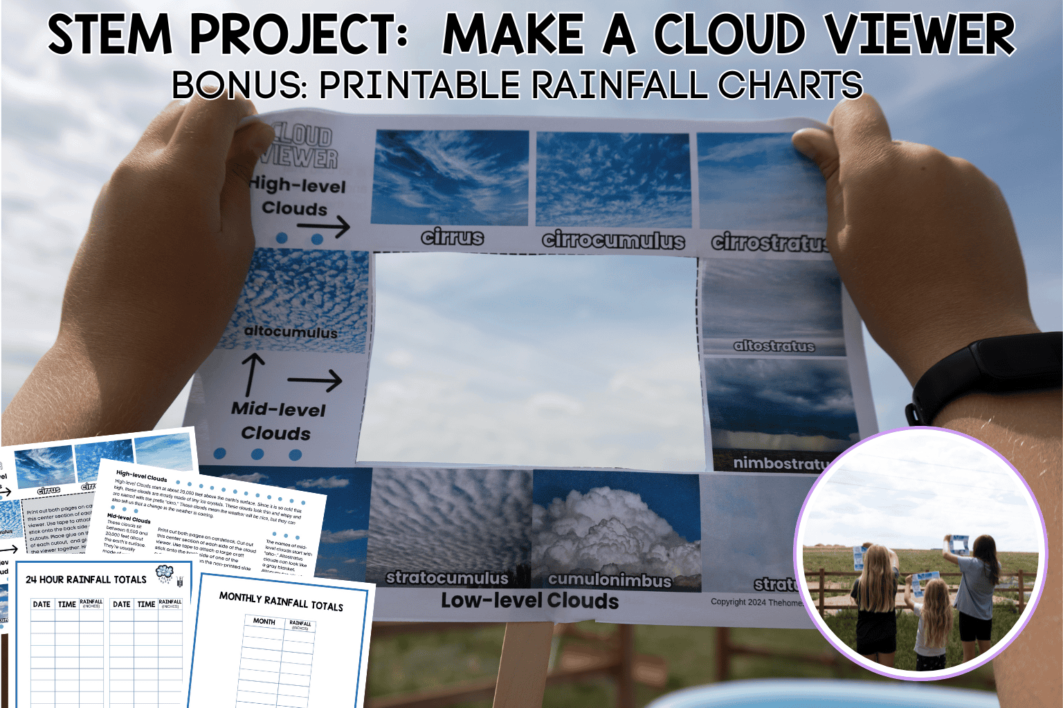
Teach your kids how to be weather forecasters by making a cloud viewer with our free cloud viewer printable.
Clouds aren’t just pretty to look at. They affect the weather in various ways. They can cause the earth’s temperature to fluctuate, and they affect precipitation. Let’s look at these in more detail.
For centuries, people have been using clouds to predict the weather. For instance, high wispy cirrus clouds, sometimes called mares’ tails, meant that within 24 hours the weather was going to change. A sky full of white clouds that look like huge balls of cotton meant that the weather was going to be good that day.
Teach your kids how to be weather forecasters. Clouds aren’t just pretty to look at. They affect the weather in various ways. They can cause the earth’s temperature to fluctuate, and they affect precipitation. Let’s look at these in more detail.
Make a Cloud Viewer with Our Free Template.
CLICK HERE TO OPEN THE CLOUD VIEWER PDF IN A NEW TAB. THEN, SAVE IT TO YOUR DEVICE.

Making a Cloud Viewer
Use the link above to open our cloud viewer template and information sheet.
You will need to gather:
- The cloud viewer free printable
- Scissors
- Large craft stick
- Glue or tape
STEP 1: print out the 2 pages of the cloud viewer and gather the materials.

STEP 2: Cut out along the center dotted lines.
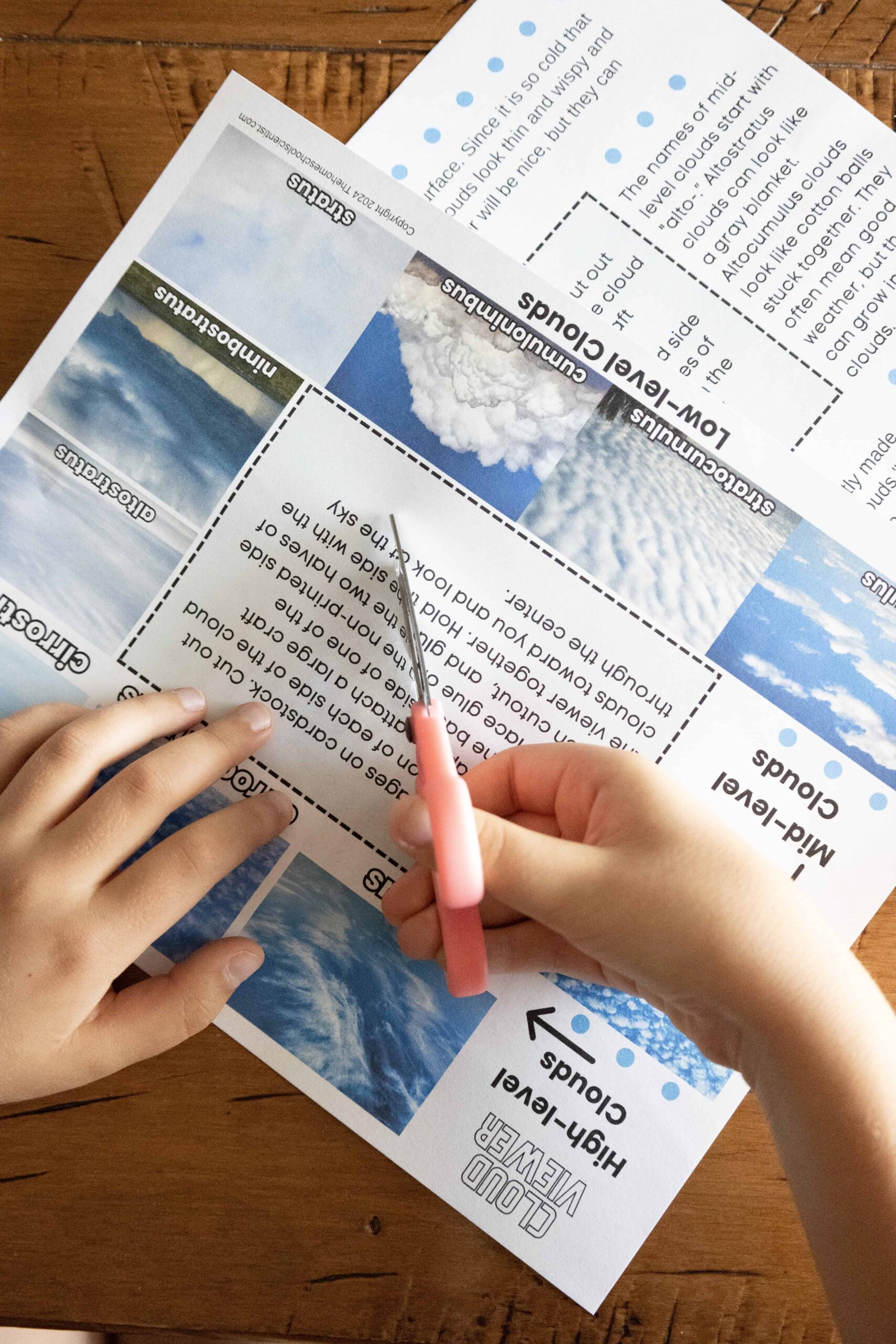
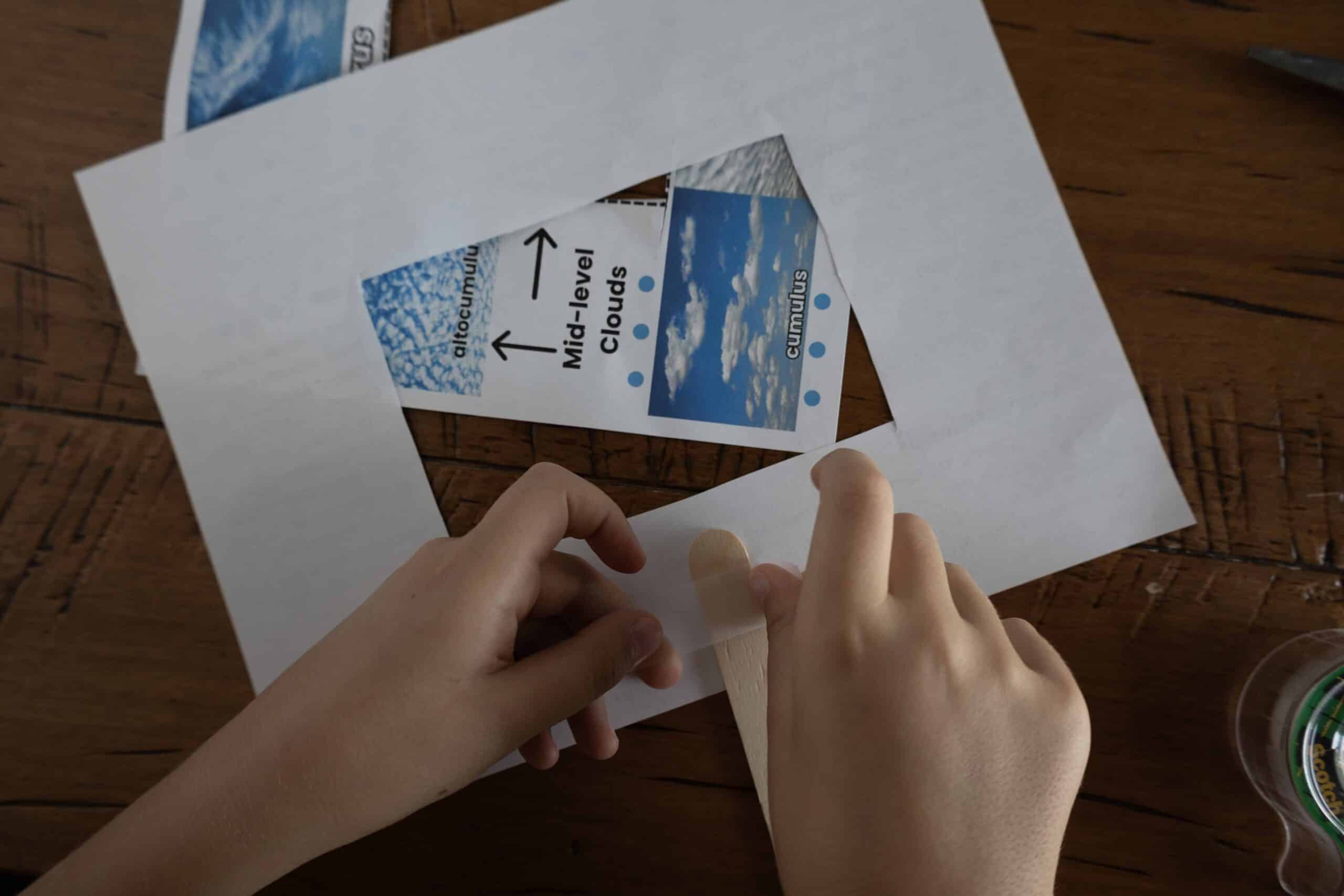
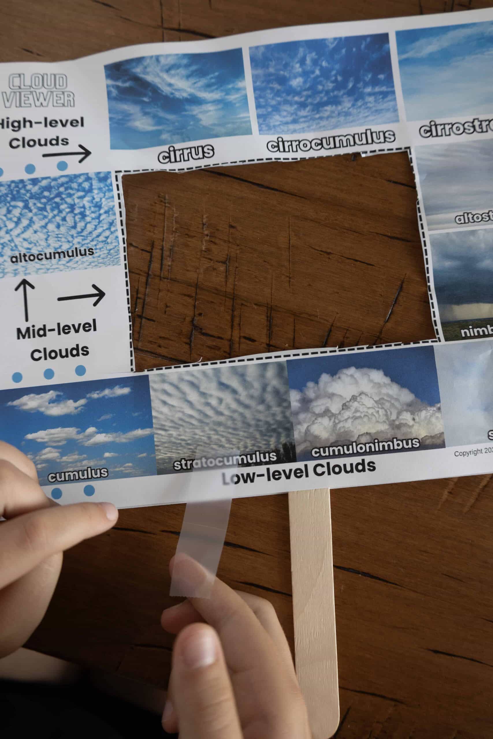
STEP 3: Tape the large craft stick to the back of one of the pages. Place it in the center as shown in the photo.
STEP 4: Glue or tape the two sides of the viewer together with the print side facing out.
STEP 5: Take your viewer outside throughout the day and week to see what types of clouds are in the sky. You might want to keep a log!
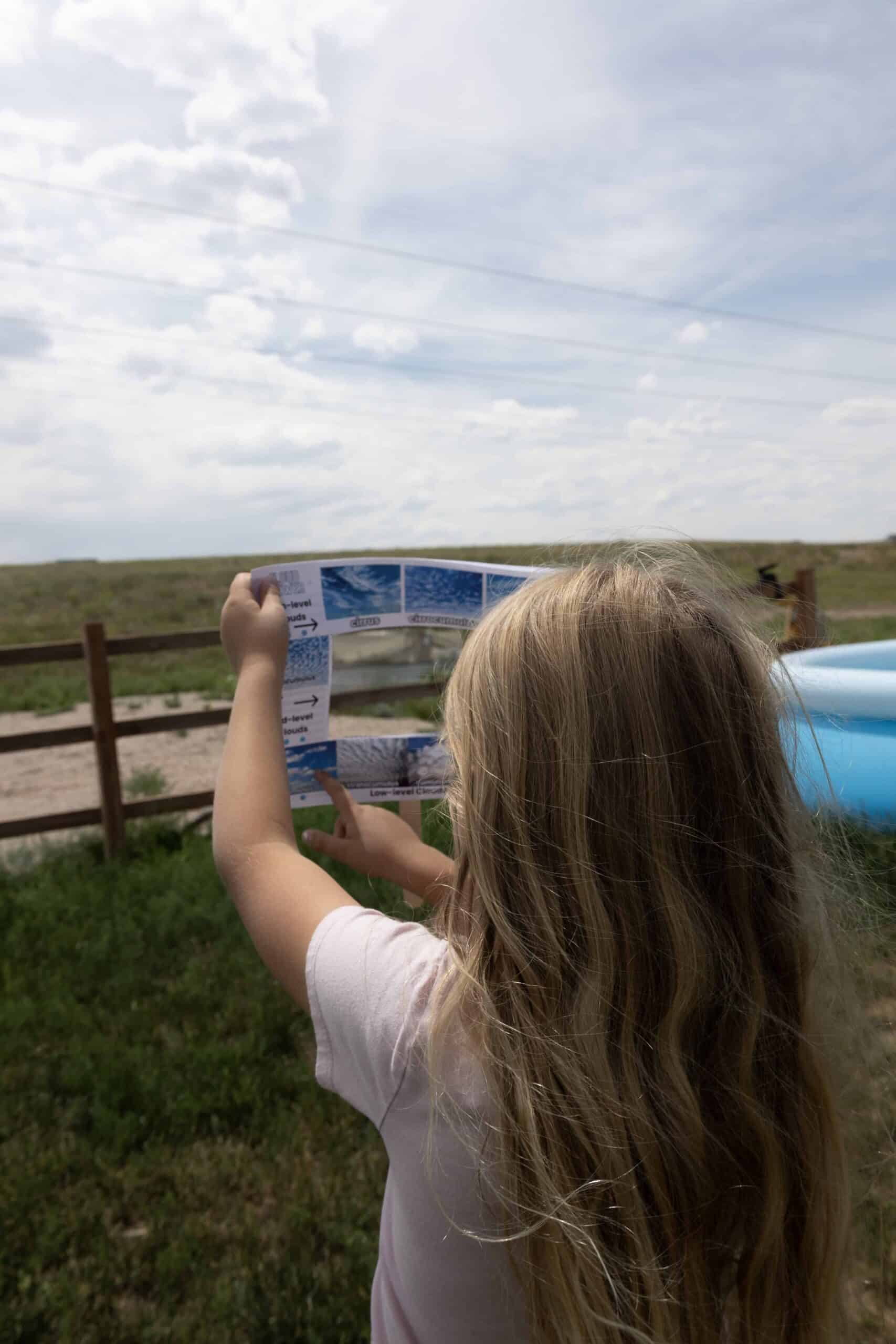
Now that you have printed the free cloud viewer worksheet and put the viewer together, read the information below and try to predict the weather at your home or school. Compare what you predict with the actual weather forecast. How did you do?
Grab the Viewer and These Cloud Cards and Head Outside
So, now it’s time to head outside and learn about the different types of clouds. Check out the information below and this printable cloud cards set. Print the cards, grab the cloud viewers, and head outside!
Cirrus Clouds
Cirrus clouds are those high wispy clouds you see high in the sky. They form at about 20,000 feet (or 6,000 meters.)
Cirrus clouds are thin and wispy clouds that appear high in the sky, often at altitudes of 20,000 feet (6,100 meters) or more. They are composed of ice crystals and are usually white, but you may also see light gray cirrus clouds. Cirrus clouds are often associated with fair weather, but can also be an indication of an approaching storm.
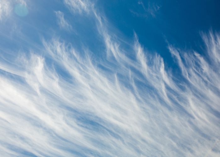
Cirrus clouds have a distinct “wispy” appearance. They kind of look like the ends long strands of hair spreading out into the atmosphere.
They are formed by the rising of moist air that then freezes at high altitudes. Cirrus clouds can also be seen in the after a storm, because they are carried by strong winds and can linger in the sky long after the storm has passed.
Cirrus clouds can be a sign of an approaching weather system, as they can indicate changes in atmospheric pressure and humidity. They are often considered to be a “high, thin veil” of clouds, and can sometimes create a “halo” effect around the sun or moon.
Seeing a few in the sky mean that fair weather is on the way. If the cirrus clouds are growing in number and almost cover the sky, look for rain within 24 hours.
Altocumulus Clouds
Altocumulus clouds are mid-level clouds that look like a layer of white and gray puffy cotton across the sky. The presence of these clouds on warm, humid mornings may mean afternoon rain is on its way.
Altocumulus clouds are mid-level clouds that typically form between 6,500 and 20,000 feet (2,000 and 6,100 meters) above the Earth’s surface. They are usually white or gray and appear as rounded and puffy with well-defined edges. Altocumulus clouds are composed of water droplets and/or ice crystals and are often associated with fair weather, but can also mean a storm is approaching.

Altocumulus clouds can occur in various forms, including individual cloudlets or groups of clouds. They may have a wave-like pattern or parallel bands, and can create a beautiful effect during sunrises and sunsets, with hues of orange, pink, and red.
Altocumulus clouds are often compared to a flock of sheep, hence the nickname “sheepback” clouds. They are categorized as a type of cumulus cloud.
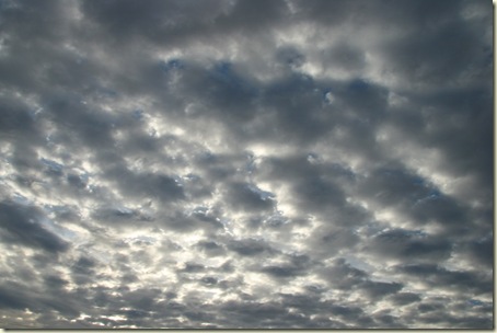
Altocumulus clouds are mid-level clouds that look like a layer of white and gray puffy cotton across the sky. The presence of these clouds on warm, humid mornings may mean afternoon rain is on its way.

Cumulus Clouds
Cumulus clouds are fair weather clouds when they are like fluffy mounds of white cotton in a blue sky. (They remind me of the clouds on the beginning of the Simpsons.)

Sometimes, cumulus clouds can build vertically into what is called cumulus congestus. These clouds resemble a head of cauliflower in shape. They are still considered fair weather clouds, but are capable of causing a short rain shower.

Cumulonimbus Clouds
Cumulonimbus clouds are sometimes called “thunder heads”. They are huge towering clouds with dark bottoms capable of producing wind, rain, lightening, hail and tornadoes. These are the most dangerous of the clouds.

Stratus Clouds
Stratus clouds are low, gray clouds that mean cold, misty rain or snow. Sometimes these clouds reach the ground and form fog.
More Weather Study Information

Get more cloud and weather information and links from the Studying The Weather post or from The Homeschool Scientist’s Weather Science Pinterest board.
Weather Predictions Project
Now comes the fun part. With your children’s new found cloud knowledge, head outside.
- Look at the clouds.
- Determine what type of clouds they are.
- Take pictures or make drawings of the sky.
- What do those clouds tell us about the weather?
- Have each child make a weather prediction. Record the predictions. Go back later to see if the predictions were correct.
- Keep a weather notebook and record the cloud types and predictions. Make a note about other weather factors like temperature, humidity and precipitation.
Have fun!
If you enjoyed this post, check out these other activities.
Learning Summer Constellations
I hold a master’s degree in child development and early education and am working on a post-baccalaureate in biology. I spent 15 years working for a biotechnology company developing IT systems in DNA testing laboratories across the US. I taught K4 in a private school, homeschooled my children, and have taught on the mission field in southern Asia. For 4 years, I served on our state’s FIRST Lego League tournament Board and served as the Judging Director. I own thehomeschoolscientist and also write a regular science column for Homeschooling Today Magazine. You’ll also find my writings on the CTCMath blog. Through this site, I have authored over 50 math and science resources.